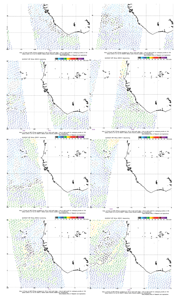
Fig. (6) http://manati.orbit.nesdis.noaa.gov/datasets/QuikSCATData.php
QuickSCAT wind bars from Sep 09 through 12, 2006. Left satellite ascending path and right satellite descending path. Winds over the ocean surface are Near Real Time (NRT); times are in Greenwich Mean Time (GMT); times correspond to 10N at right swath edge time is right awath for overlapping awaths at 10N; data buffer is twenty four hours for 060909, 060910, 0609011, and 060912; and black barbs indicate possible rain contamination. Wind vectors 15 X 30 (25km).