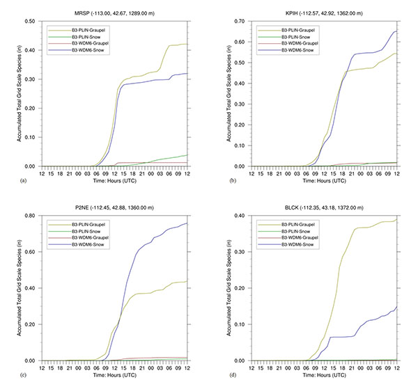
Fig. (10)
WRF-UEMS Run B3 accumulated total grid scale graupel and snow plus ice (in) using PLIN (graupel = solid yellow line, snow = solid green line) and WDM6 (graupel = solid brown line, snow = solid blue line) schemes at (a) MRSP, (b) KPIH, (c) P2NE, and (d) BLCK. The longitude (decimal degrees), latitude (decimal degrees), and station elevation (m MSL) are indicated at the top of the figures. The model run cycle is 48-hours from 1200 UTC 25 December 2003 to 1200 UTC 27 December 2003.